 |
|||||||||
 |
|||||||||
 |
|||||||||
 |
|||||||||
 |
|||||||||
| Little Sioux River - Prairie Heritage Center/Burned Bridge
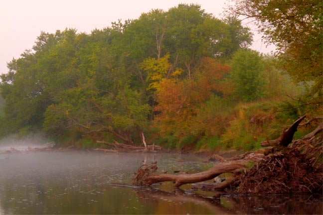
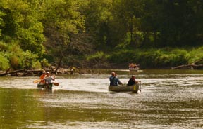
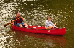
The Little Sioux River is one of Iowa’s largest interior streams. It runs for approximately 220 miles from its swampy beginnings in Dickinson County to its confluence with the Missouri River near the town of Little Sioux. The section of river running through this area is especially scenic with steep bluffs, wooded ridges and remote prairie and woodland vistas. River Corridors The river corridor provides home to a wide variety of animals. Coyotes, fox, and deer frequent the steep wooded slopes. River Otters were released into this section of the Little Sioux in 1985 as the first animals were reintroduced into Iowa. As you paddle along watch for their characteristic slides into the river. Turkey, Barred Owls, Great Blue Herons and Belted Kingfishers are commonly heard and seen along the river’s edge. Catfish and Snapping turtles are also common. Location Description and Other Information This section of the Little Sioux River has an interesting geological story. Glacial melt water held by an ice jam near the current location of Spencer broke loose at the end of the glacial time period. The rush of water changed the course of the river. The southeastern flow at the river’s beginning is diverted to a western flow along this stretch of river. The force of the water carved the steep banks and scenic valley seen today. Evidence of human habitation can be found from as far back as 1100 A.D. Mill Creek people widely used the river corridor as a location for their homes. Archaeological sites are located throughout this section of the river valley. In addition, an ancient fish weir has been located just downstream from the site. Visit the Prairie Heritage Center, located on the river bluff, for more information about the people living here before Iowa was settled by Euro-Americans. The history stories continue! In 1857, Inkapduta and his band of Sioux stopped by the residence of Hannibal Waterman located up on the ridge on the south side of the river. In 1967, a bridge over the river collapsed under the weight of a snowplow. You can see the remains of the bridge in the water today. These stories and more are also on display at the Prairie Heritage Center. This river access is ideally located a half-day’s float from Wanata Park and Martin’s Access. Grab your canoe or kayak and hit the river! • South Access – From Hwy 10, 1 mile north on Yellow Ave – Follow signs for the Prairie Heritage Center. • GPS Coordinates – South – N42deg56.085; W95deg25.105 North – N42deg56.143; W95deg29.183 • North Access – From Hwy 10, 2 miles north on Wilson Ave following the gravel road – Signs posted for Burned Bridge Access More Information and Maps You can look at a DNR map and information on exploring the Little Sioux River all the way to the Missouri River - just click on this link HERE! |
|||||||||
| To download a PDF File of this Little Sioux River Map directly from the DNR - go to this link -
http://www.iowadnr.gov/riverprograms/pubs.html This link also contains information and maps on other Iowa streams. |
|||||||||
| Visit this Little Sioux River area via Google Map by Clicking HERE!
(Please disable your browser's popup blocker before viewing map) |
|||||||||
| Take a short visit to this Little Sioux River area via the video below! | |||||||||
| Wild Categories | Photo Gallery | ||||||||||||||||