 |
||||||
 |
||||||
 |
||||||
| Stinson Prairie
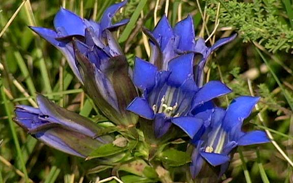
Walk the narrow footpath to the crest of the hill and look south. You are standing on the conspicuous edge of the Algona end moraine. This was the “end of the road” for the glacier that was here 12,500 years ago. As it melted, the gravel and rock that it had carried with it dropped out and remains as a high ridge today. This ridge overlooks a level outwash plain to the south and marks the last advance of the Des Moines Lobe ice sheet. Location Description Stinson Prairie displays diverse plant and animal communities ranging from pothole marsh to dry prairie. The site, however, is small and surrounded by agriculture. This has led to problems with siltation, pesticide drift and invasion of weeds. Nevertheless, nearly 200 plant species can be found here including unique plants like Needle grass, Pasque flower, Downy gentian, Rattlesnake master, and others. This site was purchased from Minnie and Emma Stinson in 1969. |
||||||
|
Driving Directions and other Information
|
||||||
Educational Activity:
|
||||||
| View Stinson Prairie via Google Map by Clicking HERE!
(Please disable your browser's popup blocker before viewing map) |
||||||
| Take a short visit to Stinson Prairie via the video below! | ||||||
| Wild Categories | Photo Gallery | ||||||||||||||||